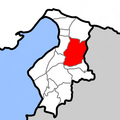
Hatay_location_Kırıkhan.png (600 × 600 píxeles; tamaño de archivo: 32 kB; tipo MIME: image/png)
Historial del archivo
Haz clic sobre una fecha y hora para ver el archivo tal como apareció en ese momento.
| Fecha y hora | Miniatura | Dimensiones | Usuario | Comentario | |
|---|---|---|---|---|---|
| actual | 18:14 25 ene 2024 |  | 600 × 600 (32 kB) | Matrix | Reverted to version as of 16:39, 24 January 2024 (UTC) |
| 17:46 24 ene 2024 |  | 600 × 600 (89 kB) | 7p-9 | Reverted to version as of 21:36, 20 January 2024 (UTC) | |
| 16:39 24 ene 2024 |  | 600 × 600 (32 kB) | Matrix | Reverted to version as of 06:43, 19 January 2024 (UTC) | |
| 21:36 20 ene 2024 |  | 600 × 600 (89 kB) | Ob9u | Reverted to version as of 04:04, 15 January 2024 (UTC) | |
| 06:43 19 ene 2024 |  | 600 × 600 (32 kB) | Aintabli | rv sock of TCfanssos | |
| 04:04 15 ene 2024 |  | 600 × 600 (89 kB) | GER212 | Reverted to version as of 06:33, 1 January 2024 (UTC) | |
| 17:42 13 ene 2024 |  | 600 × 600 (32 kB) | Aintabli | Reverted to version as of 14:16, 17 July 2016 (UTC) It turns out TCfanssos, who was behind the previous version, was a sock. In any case, seek consensus first. Other provincial maps of Turkey are in this style. We’re not going to change one province and leave the rest. | |
| 06:33 1 ene 2024 |  | 600 × 600 (89 kB) | Hatayjjv | Reverted to version as of 02:22, 22 September 2023 (UTC) | |
| 16:39 1 oct 2023 |  | 600 × 600 (32 kB) | Aintabli | Reverted to version as of 14:16, 17 July 2016 (UTC) unexplained change; first version looks much better imo | |
| 02:22 22 sep 2023 |  | 600 × 600 (89 kB) | TCfanssos | update |
Usos del archivo
La siguiente página usa este archivo:
Uso global del archivo
Las wikis siguientes utilizan este archivo:


