


| St. Andrew | ||
|---|---|---|
| Parroquia | ||
 Vista de la parroquia (Scarborough)
| ||
 St. Andrew Localización de St. Andrew en Trinidad y Tobago | ||
| Coordenadas | 11°11′12″N 60°44′41″O / 11.1867, -60.7448 | |
| Entidad | Parroquia | |
| • País |
| |
| • Isla | Tobago | |
| Población (2011) | ||
| • Total | 17 536 hab. | |
St. Andrew es una parroquia de Trinidad y Tobago.[1][2]
Geografía
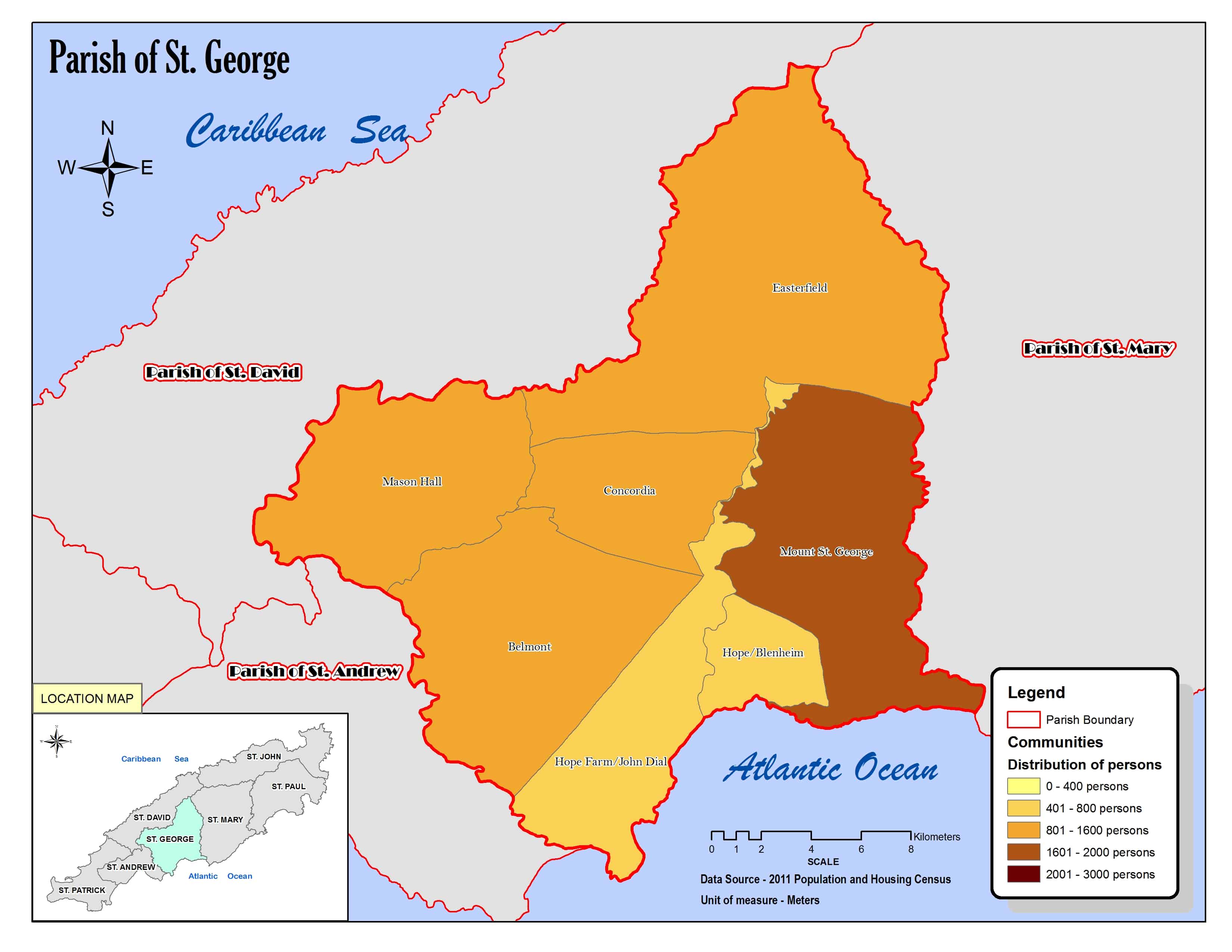
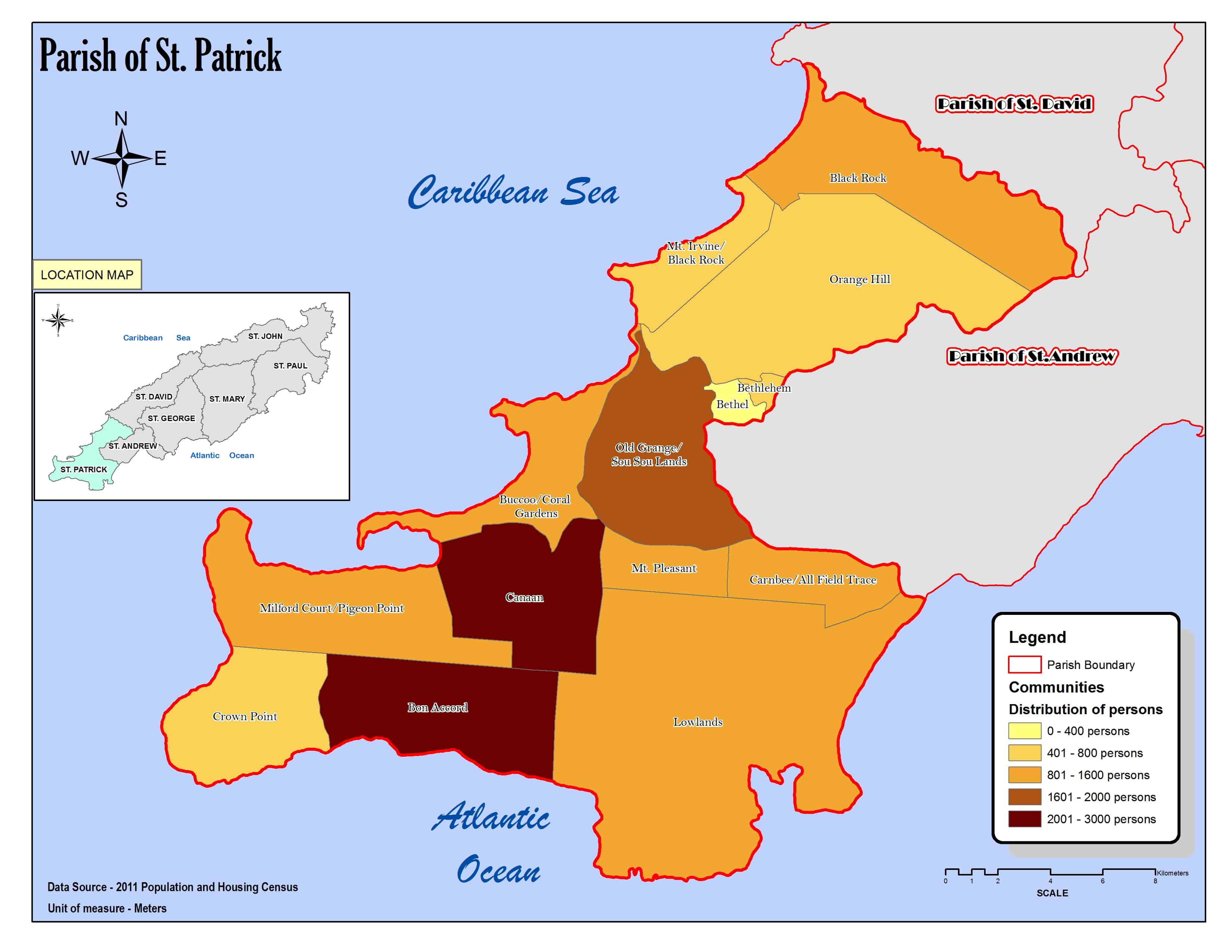
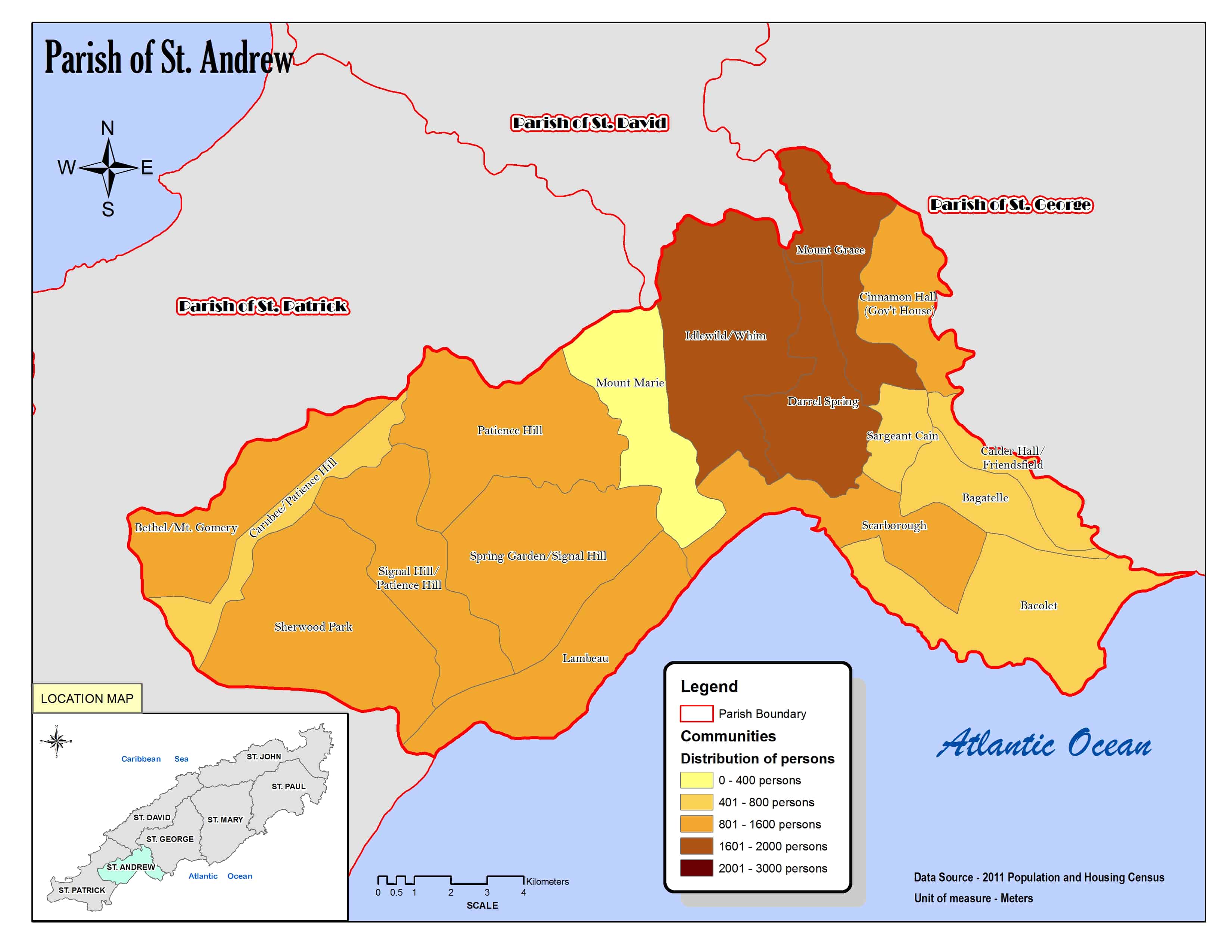
La parroquia abarca parte de la isla de Tobago y limita al norte y este con la parroquia de St. George,[3] al sur con el océano Atlántico y al oeste con la parroquia de St. Patrick.[4][5]
Organización territorial
Consta de diecisiete localidades:[5][1]
Demografía
Datos demográficos de la parroquia de St. Andrew:[1]
| Gráfica de evolución demográfica de St. Andrew entre 2000 y 2011 |
 |
Referencias
- ↑ a b c «TRINIDAD AND TOBAGO. Municipalities and Communities: The population of the cities, boroughs, regions, parishes and communities of Trinidad and Tobago by census years.». Citypopulation.de (en inglés). 18 de mayo de 2020. Consultado el 27 de septiembre de 2023.
- ↑ «Population Statistics: Demographic Profiles of Municipalities and Communities.». CENTRAL STATISTICAL OFFICE. Ministry of Planning and Development (cso.gov.tt) (en inglés). 2023. Consultado el 27 de septiembre de 2023.
- ↑ «Parish of St. George. Location map.». cso.gov.tt (en inglés). 2011. Consultado el 27 de septiembre de 2023.
- ↑ «Parish of St. Patrick. Location map.». cso.gov.tt (en inglés). 2011. Consultado el 27 de septiembre de 2023.
- ↑ a b «Parish of St. Andrew. Location map.». cso.gov.tt (en inglés). 2011. Consultado el 27 de septiembre de 2023.
Enlaces externos
 Wikimedia Commons alberga una categoría multimedia sobre St. Andrew.
| Control de autoridades |
|
|---|
 Datos: Q120794659
- Multimedia: St. Andrew Parish, Trinidad and Tobago / Q120794659